Road Improvement Plan Update
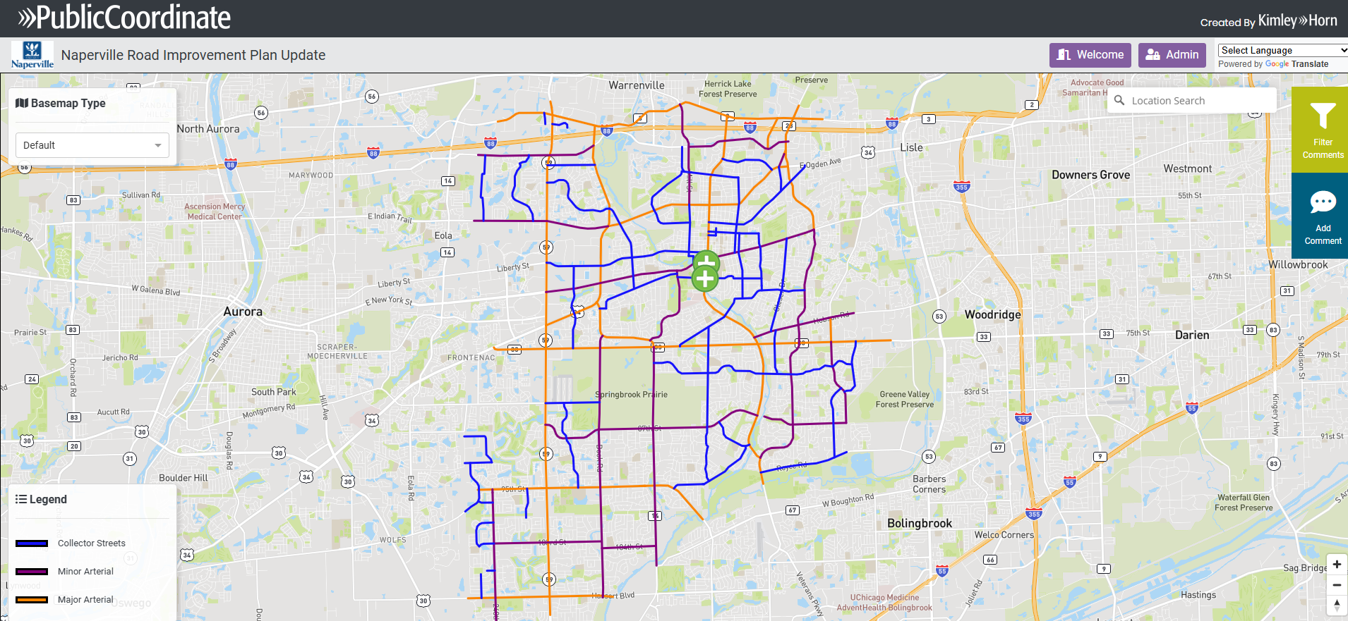
The City's Road Improvement Plan recommends road and intersection improvements needed to improve Naperville's traffic flow. The Transportation, Engineering and Development (TED) Department is working with Kimley-Horn, an engineering planning and design consultant, to update the plan to identify issues and recommend future improvements.
This update aligns with Naperville's strategic goals, as mentioned in the Naperville 2027: Investing in Our Community Priorities Plan under the Mobility focus area. This focus area's goal is to improve community mobility.

- Project Background
-
The Road Improvement Plan was created to determine what roadway improvements were needed to accommodate the City’s growth. The plan was last updated in 2007. Since then, the City has implemented many of the roadway improvement projects identified in that plan including, but not limited to:
- 75th Street and Washington Street intersection improvements. (Completed in 2012).
- Intersection improvements on Route 59 at Diehl Road, North Aurora Road and Aurora Avenue. (Completed in 2016).
- The widening of North Aurora Road between Frontenac Road and Fairway Drive. (Completed in 2023).
To ensure the City’s roadways have adequate capacity, the plan will be updated after evaluating existing traffic conditions, 2050 traffic projections and public input. Some of the information being analyzed includes traffic volumes, crash history and signal timing data at intersections and along road segments.
- Project Benefits
-
The Road Improvement Plan is a high-level, long-term evaluation of the City's roadways. Once a final plan is created, recommended improvement projects will be incorporated into the City's Capital Improvement Program within the next 20 years. Each of these projects will undergo detailed engineering and design. As part of that process, there will be additional public engagement opportunities.
Once implemented, the plan's recommended improvement projects will reduce travel time, help prevent traffic backups and delays, and lower greenhouse emissions.
- Project Timeline
-
- Jan. 28, 2025: TED and Kimley-Horn hosted an open house to give a plan overview and to gather input on the City’s roadway conditions.
- Feb. 14, 2025: Public comments closed. TED and Kimley-Horn are reviewing comments and will provide a summary of public input at an upcoming Transportation Advisory Board (TAB) workshop.
- Spring 2025 (Date TBD): A presentation of plan key findings and preliminary improvement recommendations will be discussed during a Transportation Advisory Board (TAB) workshop. Following the workshop, preliminary recommendations will be available for public review and comment.
- Later in 2025 (Date TBD): Revised plan recommendations will be shared at a second TAB workshop. Once the Road Improvement Plan is complete, recommendations will be shared with City Council. Any approved improvements will be implemented as part of the City’s Capital Improvement Program.
- Public Input
-
Public feedback will be considered throughout the planning process and will influence the plan’s recommendations. There will be future opportunities for the community to share thoughts or ideas concerning areas where they experience traffic delays, poor traffic conditions, or other traffic-related concerns. Issues specific to bicycles and pedestrians should be addressed as part of the Bicycle and Pedestrian Plan, which is anticipated to occur in 2025-2026.
- Impact
-
Major construction projects may take years to complete. Road improvements will be phased to minimize disruption to residents and businesses. More information about impacts will be shared once specific Road Improvement Plan recommendations are approved.
